
EF-2 tornado with 115 mph winds struck Grayson, Hart counties
The July 21 severe weather outbreak produced five tornadoes across central Kentucky.

MUNFORDVILLE, Ky. — The National Weather Service has confirmed five tornadoes touched down across central Kentucky during Tuesday’s severe weather outbreak.
The strongest was an EF-2 tornado that tracked through Grayson and Hart counties. Survey teams estimated peak winds reached 115 mph.
The tornado caused significant damage to homes, other structures and trees along its path.
The weather service also confirmed three EF-1 tornadoes.
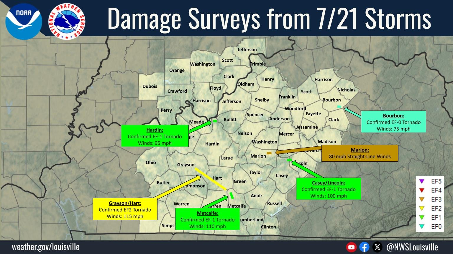
One struck Metcalfe County with peak winds of 110 mph. Another touched down in Hardin County with estimated winds of 95 mph. A third crossed Casey and Lincoln counties with winds of 100 mph.
An EF-0 tornado with peak winds of 75 mph was confirmed in Bourbon County.
In Marion County, survey teams determined damage was caused by straight-line winds rather than a tornado. Those winds reached an estimated 80 mph.
The National Weather Service released its final survey findings Thursday and said no additional damage surveys are planned.
On the Enhanced Fujita Scale, an EF-2 tornado has estimated winds between 111 and 135 mph. Tornadoes of that strength are capable of causing considerable damage, including tearing roofs from well-built homes, uprooting or snapping large trees and turning debris into dangerous projectiles.