
Strong to severe storms possible Saturday across south-central Kentucky
Forecasters warn the greatest threat for severe weather will come Saturday afternoon and evening.

GLASGOW, Ky. — South-central Kentucky could see multiple rounds of showers and thunderstorms Saturday, with some storms expected to become severe during the afternoon and evening.
According to the National Weather Service in Louisville, the first round of showers and thunderstorms is expected Saturday morning and could produce locally heavy rainfall, but severe weather is not expected.
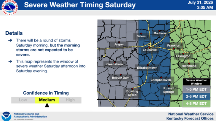
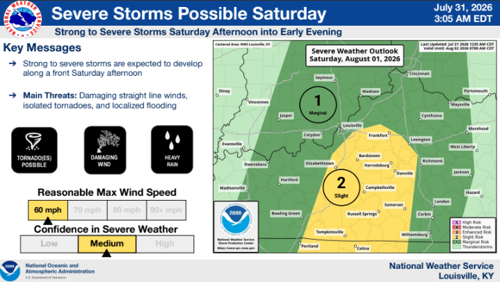
The greater threat will come Saturday afternoon into early evening, when storms could produce damaging straight-line winds, isolated tornadoes and localized flash flooding.
The Storm Prediction Center has placed much of central Kentucky under a Slight Risk (Level 2 of 5) for severe weather, meaning scattered severe storms are possible.
Forecasters encourage residents to monitor the forecast throughout the day, especially if they have outdoor plans, and to have multiple ways to receive weather warnings.
Unsettled weather is expected to continue into much of next week, with daily chances for showers and thunderstorms through at least midweek.